
Click & Color Maps
Our Click & Color maps make it easy to keep track of geographic data that too often gets lost when only using traditional people-based voter-file databases
Shapefiles
It’s easy to see the outline of counties, congressional districts, state house districts, voting precincts, etc. by browsing through our collection of shapefiles. In the example to the right, it only takes a few second to pull up all of these districts across the state of Colorado and see what they look like, in full detail.

Focus in on what matters
You can also narrow any shapefile by selecting a boundary district. In this example, we go from looking at all of the precincts in Colorado, to just those in Jefferson county, to just those in the city of Lakewood.


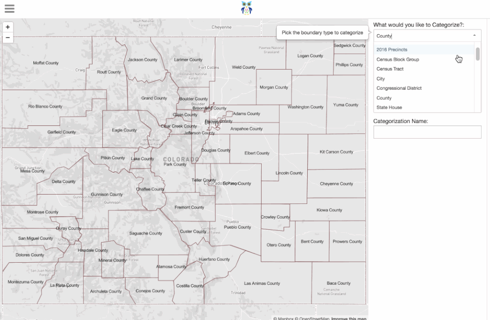
Categorize Districts
Once you’re focused on your level of detail and a boundary (e.g. precincts in Lakewood city) you can create a category by providing a name to save it as. You then create new categories and assign them to any of the districts in view, just by clicking on them. To demonstrate this, let’s say I want to keep track of where we have Precinct Captains in Lakewood, where we do not, and where we have a prospect. I’ll give my category a name, then create three other categories: (Has Captain, No Captain, Has Prospect) and give each a color.
Now that I have my Categories, I can assign them to the precincts. I’m going to change the background layer to Satellite so I can see some of the context for each precinct.
All of the selections that I make are saved in real-time and can be exported to a .csv file in a single click.
Custom Regions
The most popular use of the Click & Color maps is to define custom Field Regions. Field Regions are the geographic area of responsibility that each field region, organizer, and team, is responsible for. You’re able to sum over any list or variable that you’ve loaded into Empower Engine. These are conveniently shown in a table on the same screen. In the example below, I’m going to make sure that each organizer has about the same number of registered voters.
Custom Regions can be easily exported for loading into NGP VAN instances such as Votebuilder and Liberalist. Let us know of other integrations you’d like to see. We’re happy to build them.